![]()
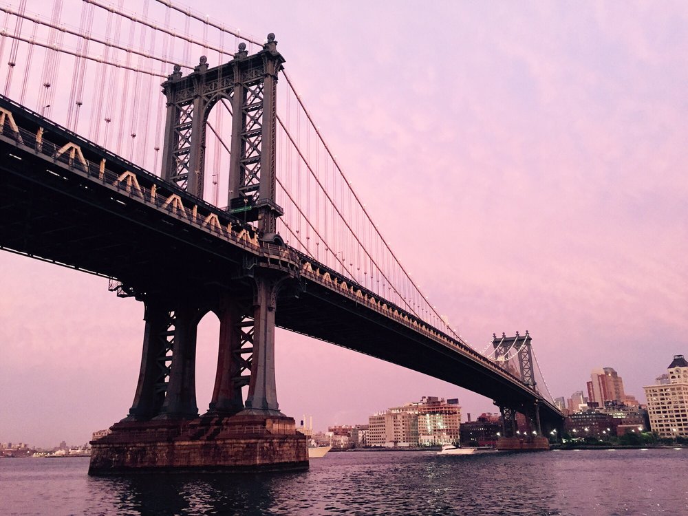
What? What?! The area in Brooklyn around Flatbush Avenue Extension in downtown Brooklyn is known as “RAMBO” (Right After the Manhattan Bridge Overpass) has showed up on Google Maps, according to NY Post. Google has set the boundaries to be between Nassau Street and Tillary Street and Flatbush Ave Extension and Gold Street. But don’t look for it anytime soon on the MTA maps, as when Dumbo was included in 2010, says a DOT staff who asked not to be named.
While we’re on Google Maps, the correct location for the F subway station (York St) has still not been fixed. The map shows that the station is on the corner of Jay and Sands Street. The correct location is on the corner of Jay and York Street. We’ve submitted this error for many months.
Do you know how Dumbo got its name?
Related:
{Google Map Adds Dumbo POIs}
{Walk Around Dumbo Using Google Maps Street View}
{The New MTA Subway Map And Yes, Dumbo Is On It}


What a silly, silly thing. Anyone who has lived in th neighborhood more than a week knows that the are has been called ‘Bridge Plaza’ for ever. In fact, in rezoning the area in 2003, City Planning and the City Council approved the plan as ‘Bridge Plaza’ rezoning (look it up). There is a community garden at the corner of Bridge and Concord called, well, Bridge Plaza Community Garden.
My undstanding is that a couple of kids living on Duffield street, as a joke, started the ‘rambo’ nonsense.
Yes, I remember the Bridge Plaza rezoning. Here is the link to the City Planning approval.
http://www.nyc.gov/html/dcp/html/bridgeplaza/bridgeplaza1.shtml
Google Maps should be properly calling the neighborhood ‘Bridge
Plaza’
Yes, I remember the Bridge Plaza rezoning. Here is the link to the City Planning approval.
http://www.nyc.gov/html/dcp/html/bridgeplaza/bridgeplaza1.shtml
Google Maps should be properly calling the neighborhood ‘Bridge
Plaza’
Indeed. I’ve known the area as Bride Plaza for many years. I love the ‘Bridge Plaza’ Garden. http://www.nyrp.org/Parks_and_Gardens/Community_Gardens/Brooklyn/Bridge_Plaza_Community_Garden
Rambo it is not!
Google Maps should have done some very basic research (a grammar school intern could have told them so). Whoever decided to include that name must hail from Dumb-bo!
dumboest name ever
dumboest name ever
I prefer, as someone living at Flatbush and Myrtle:
Origin of the
Brooklyn
And
MAnhattan Bridges
Or rather, OBAMA. Best backronym ever.
I prefer, as someone living at Flatbush and Myrtle:
Origin of the
Brooklyn
And
MAnhattan Bridges
Or rather, OBAMA. Best backronym ever.
I thought it was Beyond the In-ramp of the Manhattan Bridge Overpass.
I thought it was Beyond the In-ramp of the Manhattan Bridge Overpass.
Who cares what it used to be called. Bridge Plaza is about as boring as it gets. I say let’s go with Rambo. 🙂
Who cares what it used to be called. Bridge Plaza is about as boring as it gets. I say let’s go with Rambo. 🙂