The Geography and Map Division of the U.S. Library of Congress holds more than 4.5 million items. A small fraction of them are available digitally online, including maps of Brooklyn. Below are details of a map from 1872. Manhattan Bridge and the Brooklyn Queens Expressway hadn’t been developed yet, so there is no Pearl Street Triangle or Cadman Plaza. In the detail of what is now known as Dumbo, there used to be a “Talman Street” (?) parellel to York and Prospect Streets, now Bridge Park 1. Other streets that no longer exist are Charles Street and Green Lane, now part of the Farragut Housing Project.
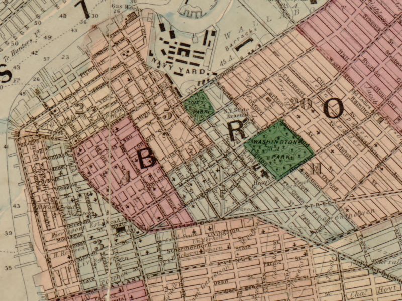
[+larger] Map courtesy of Library of Congress, 1872
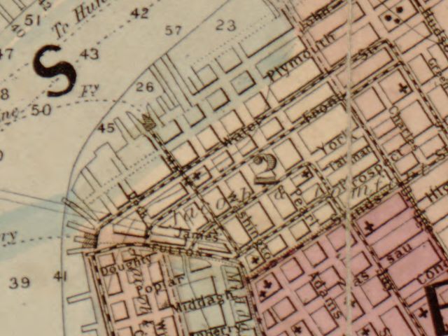
[+larger] Map courtesy of Library of Congress, 1872 (detail)


Talman street bisected what is now the fenced-in courtyard behind (east of) the F train station on York & Jay.
Talman street bisected what is now the fenced-in courtyard behind (east of) the F train station on York & Jay.